How to use drone deploy – How to use DroneDeploy? It’s easier than you think! This guide walks you through everything from setting up your account and connecting your drone to planning flights, processing data, and sharing your amazing aerial imagery. We’ll cover the basics, explore advanced features, and troubleshoot common problems, ensuring you get the most out of this powerful platform. Get ready to take your drone operations to the next level.
DroneDeploy simplifies complex drone workflows, making professional-grade aerial data accessible to everyone. From beginners just starting out to experienced professionals, this guide will empower you to confidently utilize all the features DroneDeploy offers. We’ll delve into flight planning, data processing techniques, and collaborative tools, ensuring you master this versatile platform.
Getting Started with DroneDeploy
DroneDeploy is a powerful cloud-based platform for planning, executing, and processing drone data. Its intuitive interface makes it accessible to both beginners and experienced drone pilots. This section will guide you through the initial setup and drone connection process.
DroneDeploy Platform Overview
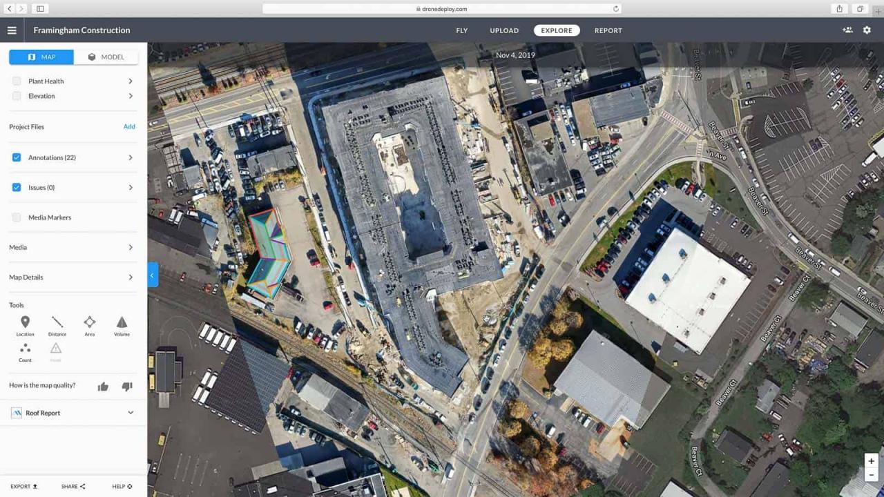
The DroneDeploy platform features a user-friendly interface centered around a map view. Users can plan flights, monitor progress, process imagery, and analyze data all within this central hub. Key functionalities include flight planning tools, real-time flight monitoring, automated image processing, and various data visualization options like orthomosaics and 3D models. The interface is designed for efficiency, guiding users through each step of the drone workflow.
Creating and Verifying a DroneDeploy Account
- Visit the DroneDeploy website and click “Sign Up”.
- Fill out the required information, including your email address and password.
- Check your inbox for a verification email from DroneDeploy. Click the link to activate your account.
- Once verified, you can log in and begin exploring the platform.
Connecting Your Drone to the DroneDeploy App
- Download the DroneDeploy mobile app (available for iOS and Android).
- Open the app and log in using your account credentials.
- Select your drone model from the list of supported drones. DroneDeploy supports a wide variety of drone models.
- Follow the on-screen instructions to connect your drone to your mobile device via Wi-Fi or other supported connection methods.
- Once connected, you should see your drone’s status and battery level displayed within the app.
Planning and Preparing Flights
Careful flight planning is crucial for successful drone operations. DroneDeploy provides tools to create efficient and safe flight plans, ensuring optimal data collection. This section covers the essential steps in flight preparation.
Designing a Flight Plan
DroneDeploy offers various flight path options, including grid, linear, and polygon flight paths. You can define the area of interest by drawing a polygon on the map. The app will then automatically generate a flight plan based on your chosen parameters. Consider factors like wind conditions and terrain when designing your flight plan to ensure smooth and efficient data acquisition.
Pre-Flight Checklists and Safety Procedures

Before each flight, always perform a thorough pre-flight checklist. This includes checking battery levels, verifying GPS signal strength, inspecting the drone for any damage, and ensuring the area is safe for drone operation. Adherence to local regulations and airspace restrictions is paramount. Familiarize yourself with emergency procedures and have a plan in place for handling unexpected situations.
Selecting Appropriate Flight Parameters
Optimal flight parameters are essential for high-quality data. Altitude should be sufficient to capture the desired area while maintaining image clarity. Overlap (both front and side) is critical for accurate image stitching during post-processing. Speed should be adjusted based on wind conditions and the desired level of detail. Experimentation and understanding of your specific drone’s capabilities will lead to optimal parameter settings.
DroneDeploy Flight Modes Comparison, How to use drone deploy

| Mode Name | Description | Suitable Use Cases | Advantages/Disadvantages |
|---|---|---|---|
| Auto | Fully automated flight planning and execution. | Large area mapping, quick surveys | Easy to use, efficient; Requires stable conditions, limited manual control |
| Manual | Pilot controls drone movements directly. | Complex areas, precision tasks | High level of control, flexibility; Requires experienced pilot, time-consuming |
| Smart | Combines automated planning with manual adjustments. | Most use cases | Balances automation and control, adaptable; May require some learning curve |
| Waypoint | Flight plan defined by user-specified waypoints. | Precise data acquisition, specific targets | Highly customizable; Requires more planning, prone to errors if not carefully set |
Executing and Monitoring Flights
Once the flight plan is ready, initiating and monitoring the flight is straightforward within the DroneDeploy app. This section Artikels the process and provides solutions for potential issues.
Initiating and Monitoring Drone Flights
After confirming all settings, initiate the flight from the app. The app provides real-time feedback on the drone’s location, battery level, and flight progress. Visual cues and notifications alert you to potential issues.
Handling Flight Issues and Interruptions

Potential issues like low battery, GPS signal loss, or wind interference may occur. DroneDeploy provides alerts for these scenarios, allowing you to take corrective action. The app might suggest emergency landing or allow for manual intervention if necessary. Always prioritize safety and land the drone safely if problems arise.
Utilizing the Live Map Feature
The live map feature shows the drone’s real-time location and flight path. This allows you to monitor progress, identify any deviations from the planned route, and make adjustments on-the-fly. This is crucial for ensuring data quality and addressing any unexpected obstacles.
Troubleshooting Common Flight Problems
- No GPS signal: Ensure the drone has a clear view of the sky, away from obstacles.
- Low battery: Land the drone immediately and replace or recharge the battery.
- Wind interference: Reduce flight speed or postpone the flight until conditions improve.
- Connection loss: Check your internet connection and drone’s Wi-Fi settings.
Processing and Analyzing Data: How To Use Drone Deploy
DroneDeploy streamlines the post-flight processing, transforming raw imagery into valuable insights. This section details the data processing options and the resulting data products.
Uploading and Processing Drone Imagery
Once the flight is complete, upload the captured images to the DroneDeploy platform. The platform automatically processes the images, generating various map products. Processing time depends on factors like image resolution, data volume, and selected processing options.
Data Processing Options
DroneDeploy offers various processing options, affecting accuracy and processing time. Higher-quality processing options provide more accurate results but require more processing time. Choosing the appropriate option depends on the project’s requirements and desired level of detail.
Getting started with DroneDeploy is easier than you think! First, you’ll want to set up your account and connect your drone. Then, check out this awesome guide on how to use DroneDeploy to learn about flight planning and data processing. After that, you’ll be capturing stunning aerial imagery and analyzing your data like a pro, mastering how to use DroneDeploy in no time.
Comparison of Map Products
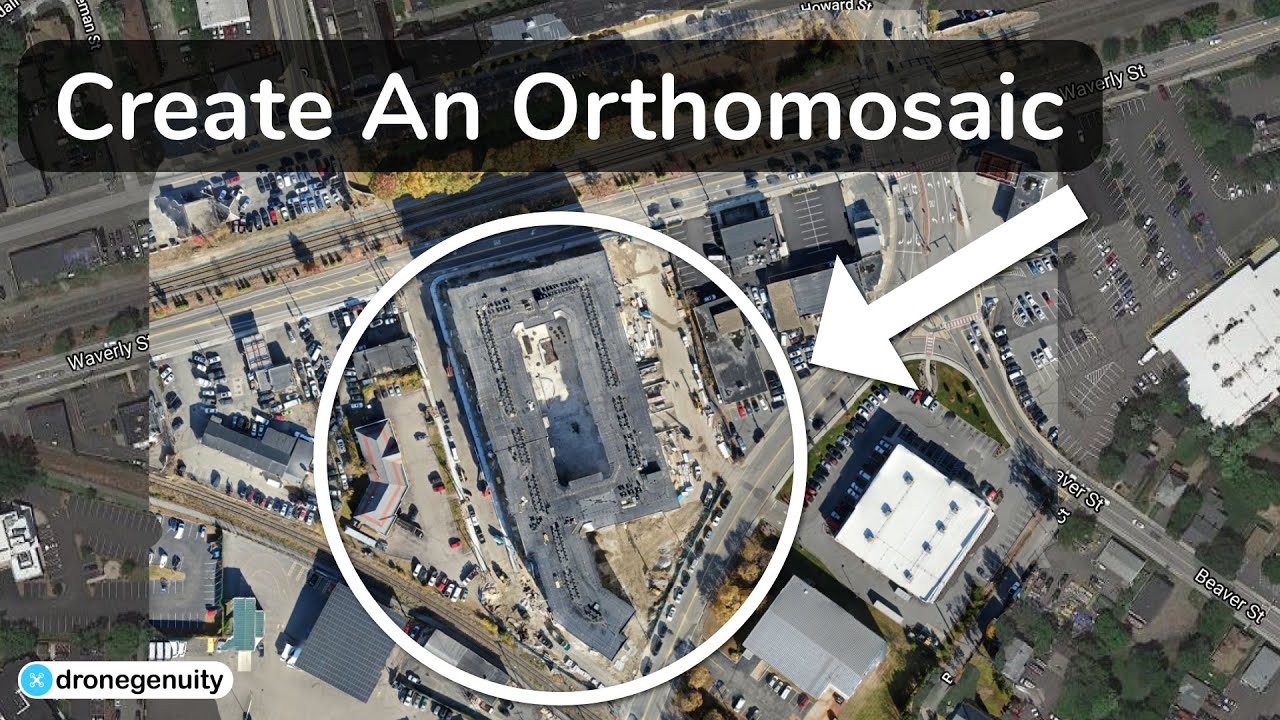
DroneDeploy generates several map products, including orthomosaics (2D maps with corrected geometry), digital surface models (DSMs), digital terrain models (DTMs), and 3D models. Orthomosaics are ideal for visual analysis, while 3D models provide a three-dimensional representation of the surveyed area. The choice depends on the specific needs of your project.
Key Metrics and Data Points
- Area measurements
- Volume calculations
- Elevation data
- Orthomosaic image
- 3D model
- Point cloud data
Sharing and Collaborating
DroneDeploy facilitates easy sharing and collaboration on projects. This section explains how to share data and collaborate with others.
Sharing Processed Data and Reports
Share processed data and reports with colleagues or clients via email, direct links, or downloadable files. DroneDeploy allows for exporting data in various formats, including PDFs, shapefiles, and KML files, catering to diverse needs and software compatibility.
Creating and Exporting Data Formats
DroneDeploy supports exporting data in various formats such as PDF reports, shapefiles for GIS software, and KML files for Google Earth. These options ensure seamless integration with other software and platforms, facilitating data analysis and visualization.
Collaborating on Projects
DroneDeploy’s team features allow for seamless collaboration. Multiple users can access and work on the same project simultaneously, enhancing team efficiency and facilitating data sharing.
Using Annotations and Measurements
Highlight specific areas of interest by adding annotations and measurements directly onto the processed data. This feature allows for easy communication and precise data analysis, improving the clarity of findings and facilitating better decision-making.
Advanced DroneDeploy Features
DroneDeploy offers several advanced features that enhance efficiency and analysis capabilities. This section explores these features and their applications.
Advanced Features Explained
Automated flight planning significantly reduces manual effort. Sophisticated 3D modeling capabilities provide detailed three-dimensional representations. Progress tracking tools offer real-time insights into project status, ensuring timely completion. These features enhance productivity and data analysis.
Getting started with drone mapping? Figuring out how to use DroneDeploy software can seem tricky at first, but it’s actually pretty straightforward. Check out this awesome guide on how to use DroneDeploy to learn the basics. Once you’ve grasped the fundamentals, you’ll be creating professional-looking maps and 3D models in no time! Mastering how to use DroneDeploy opens up a world of possibilities for aerial data collection.
Integration Capabilities
DroneDeploy integrates with various software platforms, expanding its functionality. This integration enables seamless data transfer and analysis within existing workflows. Examples include integrations with GIS software and cloud storage services.
Industry-Specific Applications
DroneDeploy finds applications across various industries, including construction, agriculture, mining, and insurance. Its versatility makes it adaptable to diverse needs and workflows, providing valuable data for various applications.
Workflow from Flight Planning to Data Analysis
Drone Flight Planning → Flight Execution and Monitoring → Data Upload and Processing → Data Analysis and Visualization → Report Generation and Sharing
DroneDeploy Security and Data Management
Data security and management are paramount in any platform. This section Artikels DroneDeploy’s security protocols and data management practices.
Security Protocols and Data Privacy
DroneDeploy employs robust security measures to protect user data and ensure privacy. Data encryption, access controls, and regular security audits are implemented to maintain a secure environment. The platform adheres to industry best practices for data security and privacy.
Managing Projects and Data
Organize projects and data efficiently within the platform. Use folders, tags, and search functionalities to easily locate and manage your projects and data. This organizational structure streamlines workflows and facilitates efficient data access.
Managing User Permissions and Access Controls
Control access to projects and data by assigning specific permissions to users. This ensures data security and prevents unauthorized access. Granular control over user permissions allows for tailored access based on roles and responsibilities.
Backing Up and Archiving Drone Data
Regularly back up and archive drone data to prevent data loss. DroneDeploy provides options for exporting data and storing it in various locations. Maintaining backups is crucial for data security and long-term accessibility.
Mastering DroneDeploy opens up a world of possibilities. From creating stunning orthomosaics and 3D models to efficiently managing projects and collaborating with teams, this platform empowers you to capture, process, and share high-quality aerial data with ease. Remember to utilize the advanced features, stay updated on best practices, and explore the many industry-specific applications. Happy flying!
FAQ Overview
What types of drones are compatible with DroneDeploy?
DroneDeploy supports a wide range of drones from various manufacturers. Check their compatibility list on their website for the most up-to-date information.
How much does DroneDeploy cost?
DroneDeploy offers various subscription plans to suit different needs and budgets. Visit their website for pricing details and to find a plan that works for you.
Can I use DroneDeploy offline?
While some aspects of DroneDeploy can be used offline (like reviewing processed data), many core functions require an internet connection for flight planning, uploading data, and processing.
What kind of storage space do I need for DroneDeploy?
The storage space needed depends on the size and resolution of your drone imagery. DroneDeploy offers cloud storage, but it’s good practice to have local backups as well.
